Activity: Hiking | Difficulty: Hard | Location: Snowdonia, Wales
The Pyg Track is a challenging hike with steep climbs and rocky terrain, suitable for experienced hikers. The route offers breathtaking views and a rewarding summit experience.
Adventure Statistics
- Distance: 10.5km
- Duration: 1h 42m
- Elevation Gain: 758m
- Max Elevation: 1085m
- Calories Burned: 765
- Best Seasons: Spring, Summer, Fall
- Features: Viewpoint, Summit, Forest, Rocky terrain, Wildlife_viewing, Historical_site
Photos

Location Overview
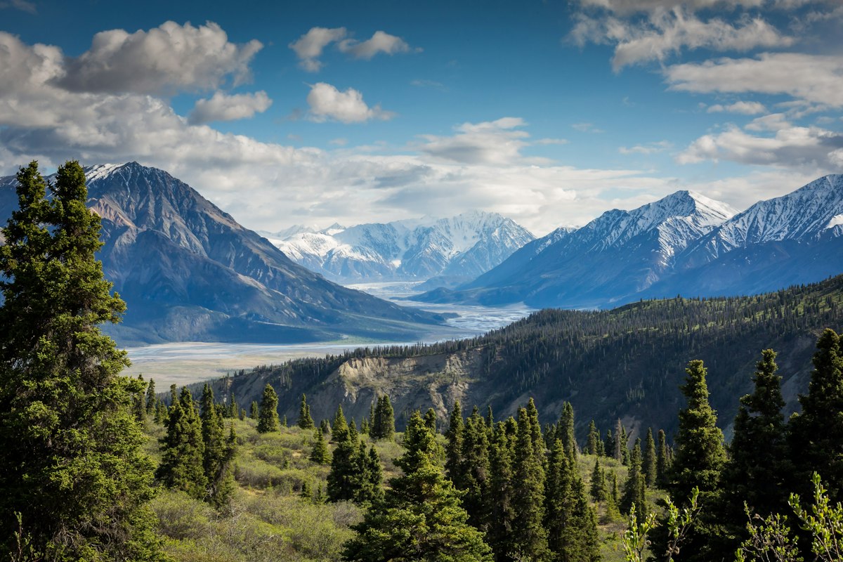
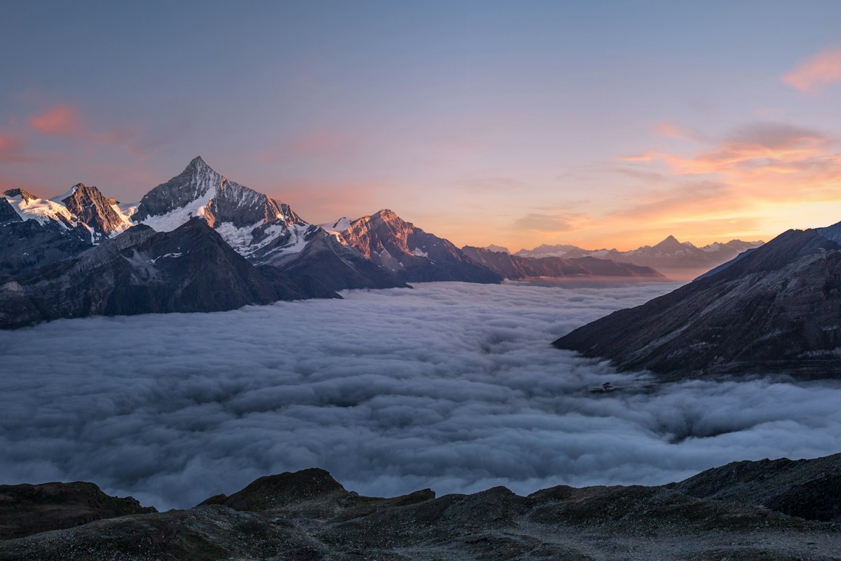
<p>Located in the heart of Snowdonia National Park, the Pyg Track offers a unique and exhilarating hiking experience. Snowdonia is one of the most beautiful and dramatic landscapes in the United Kingdom, characterized by its towering peaks, deep valleys, and crystal-clear lakes. The park covers over 823 square kilometers and is home to a diverse range of flora and fauna. The Pyg Track itself is situated in the northern part of the park, near the village of Llanberis. The trailhead is just a short drive from the popular town of Betws-y-Coed, making it easily accessible for visitors. The landscape along the Pyg Track is a mix of rugged terrain, rocky outcrops, and lush greenery. As you hike, you'll pass through areas of heather and grassland, with the occasional glimpse of wildflowers and wildlife. The route is known for its dramatic changes in elevation, offering both challenging climbs and rewarding descents. The Pyg Track is not just a hike; it's an adventure that immerses you in the natural beauty and rich history of Snowdonia National Park.</p>
Key Points of Interest
<p><ul><li>Pen y Pass: The starting point of the Pyg Track, this car park offers stunning views of the surrounding peaks and is a popular spot for hikers and climbers.</li><li>Bwlch y Moch: This high pass offers panoramic views of the Llanberis Pass and the surrounding mountains, making it a great place to stop and take in the scenery.</li><li>Crib Goch: Known as the 'Red Ridge,' this narrow and exposed section of the trail is one of the most dramatic parts of the Pyg Track. It offers breathtaking views but requires caution and a good head for heights.</li><li>Pyg Pass: Another high pass on the route, Pyg Pass provides a brief respite from the steep climbs and a chance to catch your breath before the final ascent to the summit.</li><li>Snowdon Summit: The ultimate goal of the Pyg Track, the summit of Snowdon offers 360-degree views of the surrounding landscape. The summit is home to a visitor center, café, and the Snowdon Summit Railway, making it a bustling hub of activity.</li><li>Watkin Path: For those looking to extend their adventure, the Watkin Path offers an alternative descent route from the summit. This historic path is named after Sir Edward Watkin, who built it in the late 19th century.</li></ul></p>
Route Waypoints
- Bwlch y Moch: High pass with panoramic views.
- Crib Goch: Dramatic red ridge with exposed sections.
- Pyg Pass: Another high pass before the final ascent.
- Snowdon Summit: Highest point in Wales with a visitor center.
Getting to the Start
<p>To reach the start of the Pyg Track, you'll need to head to the village of Llanberis, which is located in the northern part of Snowdonia National Park. The nearest town is Betws-y-Coed, which is about a 20-minute drive away. From Betws-y-Coed, take the A4086 towards Llanberis. As you approach Llanberis, follow the signs to Pen y Pass, which is the main car park and trailhead for the Pyg Track. There is ample parking at Pen y Pass, but it can get busy, especially during the summer months. If you prefer public transport, there are regular bus services from Betws-y-Coed to Llanberis, and from there, you can take a local bus or taxi to Pen y Pass. The bus journey from Betws-y-Coed to Llanberis takes about 30 minutes. Alternatively, you can take the Snowdon Sherpa bus service, which runs during the summer months and provides a direct route to Pen y Pass from several nearby towns.</p>
Tips, Safety & Travel
<p>Hiking the Pyg Track requires preparation and a good understanding of the trail conditions. Essential kit includes sturdy hiking boots, layered clothing, a waterproof jacket, and a backpack with plenty of water and snacks. It's also a good idea to bring a map and compass, as well as a fully charged mobile phone. The trail can be challenging, especially in wet or icy conditions, so be prepared for steep climbs and rocky terrain. Weather conditions can change rapidly in Snowdonia, so always check the forecast before setting out. The best time to hike the Pyg Track is during the summer months, when the days are longer and the weather is generally more favorable. However, the trail can be hiked year-round, with the exception of extremely harsh winter conditions. If you're new to hiking, consider joining a guided tour or hiking with a more experienced friend. Always let someone know your planned route and expected return time, and carry a first-aid kit and emergency supplies. In case of an emergency, the nearest hospital is in Bangor, and there are mountain rescue teams based in the area. Enjoy the adventure, but prioritize safety and respect the natural environment.</p>
Wildlife & Nature Highlights
<p>The Pyg Track is a haven for wildlife enthusiasts, offering the opportunity to observe a variety of flora and fauna. As you hike, keep an eye out for the Snowdon lily (<i>Gagea serotina</i>), a rare plant found only in a few locations in Snowdonia. The heather-covered slopes are also home to a range of wildflowers, including the bell heather and cross-leaved heath. The area is a habitat for several bird species, including the peregrine falcon, which nests on the cliffs and can often be seen soaring overhead. Red kites are also a common sight, and you might hear the distinctive call of the raven echoing through the valleys. The rocky outcrops and boulder fields provide shelter for small mammals like the mountain hare and the common shrew. If you're lucky, you might spot a red squirrel, which is a protected species in the area. The Pyg Track is also a great place for geology enthusiasts, as the landscape is rich in glacial features and ancient rock formations. The area is a prime example of the effects of glaciation, with U-shaped valleys, cirques, and moraines visible throughout the route.</p>
Tags
- hiking
- mountain
- scenic
- challenging
- outdoor adventure
- national park