Activity: Hiking | Difficulty: Hard | Location: Eysturoy, Faroe Islands
The hike to Slaettaratindur is a challenging out-and-back route that covers a distance of approximately 16 km. The terrain is varied, with steep ascents and rocky sections, making it suitable for experienced hikers.
Adventure Statistics
- Distance: 16.0km
- Duration: 2h 35m
- Elevation Gain: 872m
- Max Elevation: 882m
- Calories Burned: 1166
- Best Seasons: Summer, Fall
- Features: Summit, Viewpoint, Forest, Wildlife_viewing, Historical_site, Parking
Photos
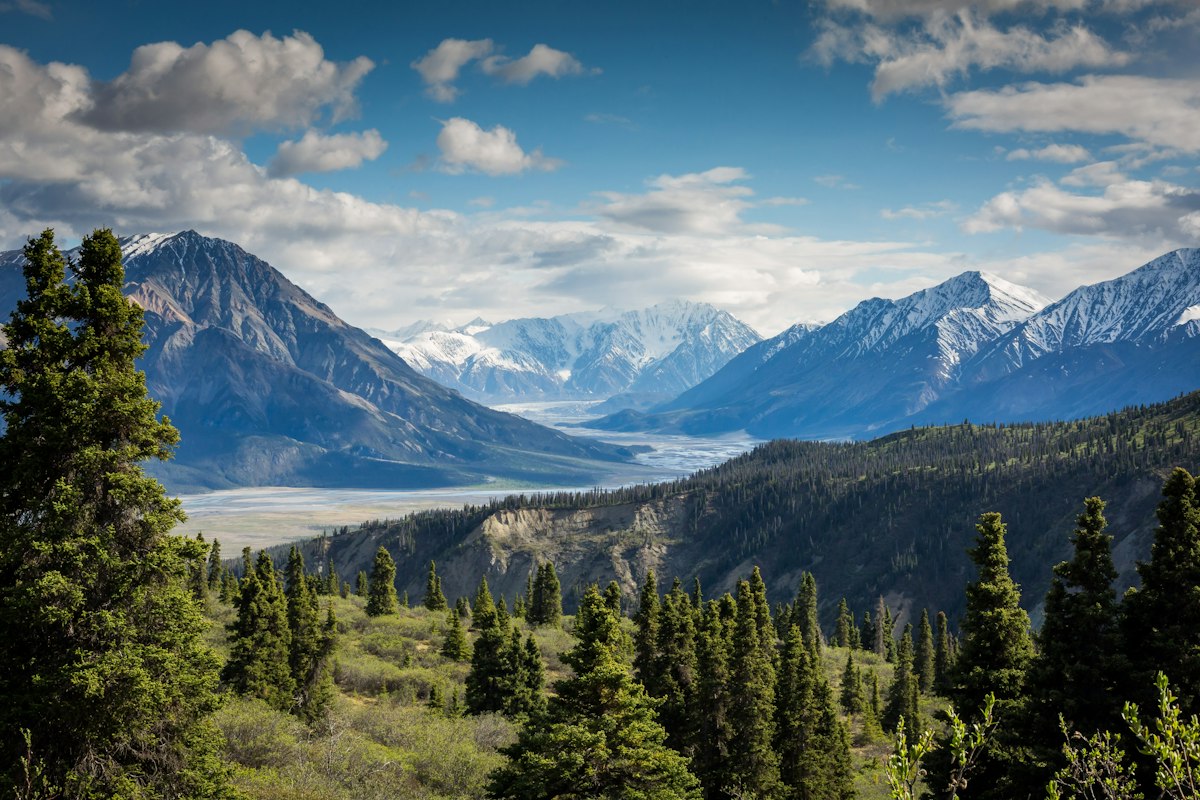


Location Overview
<p>Eysturoy, one of the largest and most populous islands in the Faroe Islands, is a hiker's paradise. The island is characterized by its dramatic cliffs, deep valleys, and rolling hills, making it a perfect destination for those seeking a challenging yet rewarding hiking experience. The landscape of Eysturoy is a blend of rugged terrain and lush greenery, with the Atlantic Ocean providing a stunning backdrop to every step of your journey.</p><p>The island's geography is shaped by its volcanic origins, resulting in a diverse range of natural features. From the towering summit of Slaettaratindur to the serene lakes and waterfalls, Eysturoy offers a variety of landscapes that cater to different hiking preferences. The island is also home to several small villages, each with its own unique charm and cultural heritage. These settlements provide a glimpse into the traditional Faroese way of life, adding a cultural dimension to your hiking adventure.</p><p>The climate of Eysturoy is subpolar oceanic, which means that you can expect mild temperatures and frequent rain, especially during the summer months. However, the weather can be unpredictable, and it's essential to be prepared for changing conditions. Despite the challenges, the weather also adds to the island's mystique, creating a dynamic and ever-changing landscape that is both beautiful and awe-inspiring.</p>
Key Points of Interest
<p><strong>Eidi Village:</strong> The trailhead is located near the village of Eidi, a small settlement with a rich cultural heritage. The village is a great place to start your hike, offering a glimpse into the traditional Faroese way of life.</p><p><strong>Grassy Meadows:</strong> As you begin your ascent, you'll pass through lush grassy meadows that are home to a variety of wildflowers and Faroese sheep. The gentle slopes provide a scenic introduction to the hike.</p><p><strong>Rocky Cliffs:</strong> As you gain elevation, the terrain becomes more rugged, with rocky cliffs and boulders lining the trail. These cliffs offer stunning views of the Atlantic Ocean and the surrounding landscape.</p><p><strong>Valley of Eidi:</strong> The trail takes you through the beautiful Valley of Eidi, a picturesque area with a serene atmosphere. The valley is a great place to take a break and enjoy the natural surroundings.</p><p><strong>Summit of Slaettaratindur:</strong> The highlight of the hike is reaching the summit of Slaettaratindur, the highest peak in the Faroe Islands. At 882 meters above sea level, the summit offers panoramic views of the islands and the Atlantic Ocean.</p><p><strong>Return to Eidi:</strong> After enjoying the views from the summit, the trail descends back to Eidi, providing a different perspective of the landscape. The return journey is just as scenic, with the changing light and angles offering new views of the terrain.</p>
Route Waypoints
- Grassy Meadows: Lush meadows with wildflowers and Faroese sheep.
- Rocky Cliffs: Stunning views of the Atlantic Ocean and rugged cliffs.
- Valley of Eidi: A picturesque valley with serene surroundings.
- Summit of Slaettaratindur: The highest peak in the Faroe Islands, offering panoramic views.
Getting to the Start
<p>To begin your hike to Slaettaratindur, you'll need to reach the village of Eidi, located on the northeastern coast of Eysturoy. The nearest town with significant infrastructure is Klaksvík, which is about a 30-minute drive from Eidi. From Klaksvík, take the road Eysturoyarvegur (Road 1) south towards Eidi. The road is well-maintained and offers scenic views of the coastline and the surrounding hills. As you approach Eidi, you'll find a small car park near the start of the trail. The car park is free and can accommodate a limited number of vehicles, so it's advisable to arrive early, especially during peak hiking seasons.</p><p>If you're traveling by public transport, there are bus services that connect Klaksvík to Eidi. The bus stop in Eidi is a short walk from the trailhead, making it a convenient option for those who prefer not to drive. It's important to check the bus schedules in advance, as they can be infrequent, especially on weekends and during the off-season. Once you arrive in Eidi, the trailhead is clearly marked, and you can begin your ascent to Slaettaratindur.</p>
Tips, Safety & Travel
<p>Parking at the trailhead in Eidi is free and can accommodate a limited number of vehicles. It's advisable to arrive early to secure a spot, especially during peak hiking seasons. The best time to hike Slaettaratindur is during the summer months, from June to August, when the weather is generally milder and the days are longer. However, the weather can be unpredictable, and it's essential to be prepared for changing conditions. Bring layers, waterproof gear, and sturdy hiking boots to ensure a comfortable and safe journey.</p><p>It's important to carry plenty of water and snacks, as there are no facilities along the trail. A map and a compass or a GPS device are also recommended, as the trail can be challenging in certain sections. Always let someone know about your hiking plans and expected return time. In case of an emergency, the nearest medical facilities are in Klaksvík, and the local authorities can be contacted for assistance. The terrain is steep in some areas, so use caution and take your time. Enjoy the hike to Slaettaratindur, and remember to respect the natural environment and the local community.</p>
Wildlife & Nature Highlights
<p>The hike to Slaettaratindur is not only a physical challenge but also a wildlife enthusiast's dream. The rugged terrain and diverse ecosystems of Eysturoy support a wide variety of flora and fauna. As you make your way up the trail, keep an eye out for the Atlantic puffin, a small seabird known for its colorful beak and comical appearance. These birds nest in the cliffs and can often be seen flying to and from the sea, gathering food for their chicks.</p><p>In the grassy meadows and moorlands, you might encounter the Faroese sheep, a hardy breed that has adapted to the harsh climate of the islands. These sheep are a common sight and are an integral part of the Faroese landscape. The meadows are also home to a variety of wildflowers, including the Faroese buttercup and the purple saxifrage, which add a splash of color to the green hillsides.</p><p>The rocky terrain of the higher elevations is a habitat for birds of prey, such as the peregrine falcon and the golden eagle. These majestic birds can often be seen soaring above the cliffs, hunting for their prey. The area around Slaettaratindur is also known for its geology, with the exposed rock formations providing a glimpse into the island's volcanic past. The combination of wildlife, flora, and geology makes the hike to Slaettaratindur a rich and rewarding experience for nature lovers.</p>
Tags
- hiking
- summit
- outdoor adventure
- Faroe Islands
- scenic views
- wildlife
- challenging
- nature