Activity: Hiking | Difficulty: Hard | Location: Ayrshire, Scotland
The Ayrshire Summit Trail is a challenging hiking route that takes you to the highest point near Ayrshire, offering stunning views and a sense of accomplishment. The terrain is varied, including forest, moorland, and rocky paths, and the route is primarily an out-and-back trail.
Adventure Statistics
- Distance: 12.5km
- Duration: 2h 1m
- Elevation Gain: 369m
- Max Elevation: 519m
- Calories Burned: 911
- Best Seasons: Spring, Summer, Fall, Winter
- Features: Summit, Viewpoint, Forest, Moorland, Historical_site, Wildlife_viewing
Photos
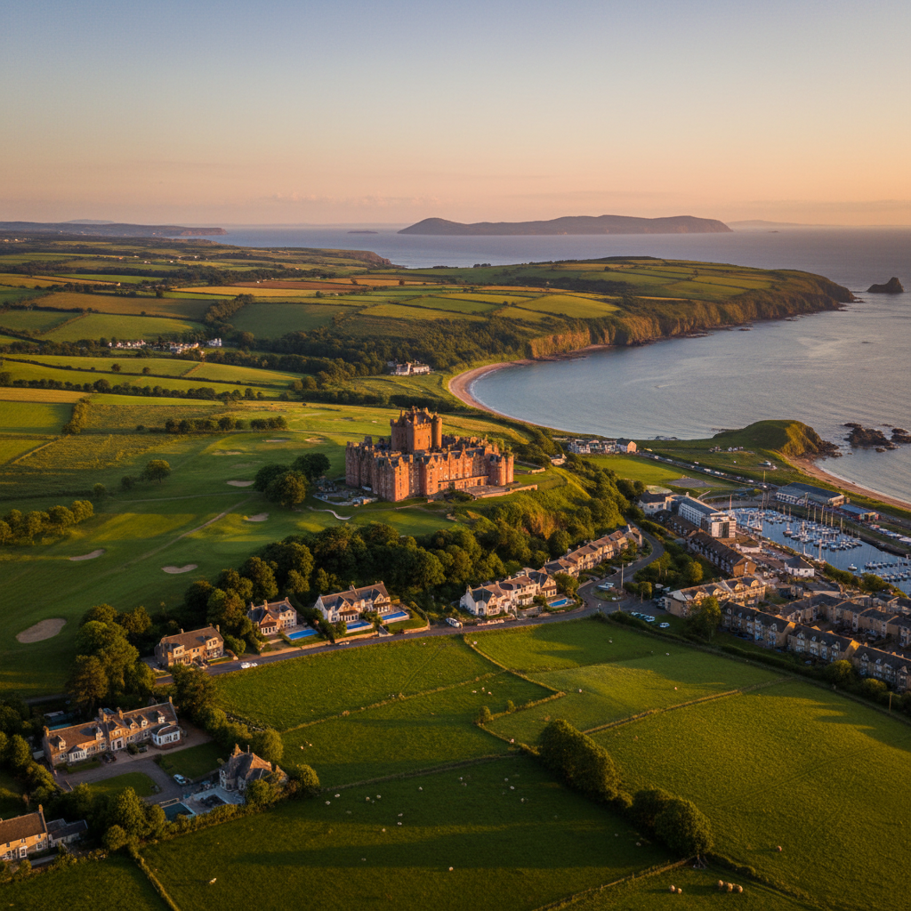
Location Overview
<p>Ayrshire, located in the west of Scotland, is a region of striking natural beauty and diverse landscapes. The Ayrshire Summit Trail is set against the backdrop of the Southern Uplands, a range of hills that stretch across the southern part of Scotland. The trail begins near the village of Dalmellington, a charming and historic community known for its rich mining heritage. The surrounding area is characterized by rolling hills, dense woodlands, and open moorlands, creating a landscape that is both rugged and picturesque.</p><p>The geology of the region is particularly interesting, with the Southern Uplands being part of the Caledonian mountain range, which was formed over 400 million years ago. The hills are composed of a mix of sedimentary and metamorphic rocks, including greywacke and schist, which contribute to the unique character of the landscape. The area is also home to several small rivers and streams, which carve their way through the hills, adding to the natural beauty of the region.</p><p>One of the most appealing aspects of the Ayrshire Summit Trail is its accessibility. Despite its challenging nature, the trail is relatively easy to reach, making it a popular destination for hikers of all skill levels. The trailhead is located near the village of Dalmellington, which is well-connected by both road and public transport. The village itself is a charming place to visit, with a range of amenities and a friendly community that adds to the overall experience of hiking in Ayrshire.</p><p>The Ayrshire Summit Trail is not just a physical challenge; it is also a journey through the natural and cultural heritage of the region. The trail passes by several historical sites and landmarks, including old mine workings and ancient stone circles, which provide a glimpse into the rich history of the area. The combination of natural beauty, historical significance, and the sense of adventure that the trail offers makes it a truly special destination for hiking enthusiasts visiting Ayrshire.</p>
Key Points of Interest
<p><strong>Trailhead Car Park:</strong> The starting point of the Ayrshire Summit Trail is the car park at the end of the B7024. This is where you'll begin your adventure, and it's a good place to prepare for the hike by checking your gear and enjoying the scenic surroundings.</p><p><strong>Dalmellington Mineral Railway:</strong> As you leave the car park, you'll pass by the remains of the Dalmellington Mineral Railway, a historical site that offers a glimpse into the region's mining heritage. The railway was once used to transport coal and iron ore, and the old tracks and buildings are a testament to the area's industrial past.</p><p><strong>Forest of Ae:</strong> The trail soon enters the Forest of Ae, a vast woodland that is part of the Galloway Forest Park. The forest is home to a variety of trees, including oak, birch, and pine, and the dense canopy provides a cool and shaded environment. The forest is also a haven for wildlife, and you may spot birds such as the red squirrel and the tawny owl.</p><p><strong>Heather Moorland:</strong> As you gain elevation, the forest gives way to open moorland, characterized by vast stretches of heather and other hardy plants. The moorland is a stark and beautiful landscape, offering panoramic views of the surrounding hills and valleys. The heather is especially vibrant during the summer months, creating a sea of purple that is a photographer's dream.</p><p><strong>Cairn Table Summit:</strong> The highlight of the Ayrshire Summit Trail is the summit of Cairn Table, which stands at 519 meters above sea level. The summit is marked by a cairn, and the views from the top are simply breathtaking. On a clear day, you can see the Isle of Arran, the Firth of Clyde, and the distant peaks of the Southern Uplands. The sense of accomplishment when you reach the summit is unparalleled, making it a truly memorable moment on the trail.</p><p><strong>Return to Trailhead:</strong> After enjoying the views from the summit, the trail descends back through the moorland and forest, eventually returning to the car park. The descent is generally easier than the ascent, but it's still important to take your time and enjoy the scenery. The return journey is just as rewarding, with new perspectives and angles to appreciate.</p>
Route Waypoints
- Dalmellington Mineral Railway: Historical site with remains of the old railway used for transporting coal and iron ore.
- Forest of Ae: Entry into the vast woodland that is part of the Galloway Forest Park.
- Heather Moorland: Open moorland characterized by vast stretches of heather and panoramic views.
- Cairn Table Summit: The highest point of the trail, offering breathtaking 360-degree views.
Getting to the Start
<p>To reach the start of the Ayrshire Summit Trail, you can drive from the nearest town, Dalmellington, which is located approximately 5 miles from the trailhead. The most direct route is via the A713, which connects Dalmellington to the larger town of Cumnock. From Dalmellington, follow the A713 north for about 3 miles until you reach the signpost for the Dalmellington Mineral Railway. Turn left onto the B7024 and continue for about 2 miles until you reach the car park at the start of the trail.</p><p>The car park is located at the end of the B7024 and is well-marked with signs for the Ayrshire Summit Trail. The car park is large enough to accommodate several vehicles and is free of charge. It is a popular spot, especially on weekends, so it's a good idea to arrive early to secure a parking spot. The car park also has basic facilities, including picnic tables and trash bins, making it a convenient place to prepare for your hike.</p><p>If you prefer to use public transport, the nearest train station is in Dalmellington, which is served by ScotRail services. From the station, you can take a local bus or taxi to the trailhead. The bus service is limited, so it's advisable to check the timetable in advance. Alternatively, you can walk from the station to the trailhead, which is about a 30-minute walk along the B7024.</p>
Tips, Safety & Travel
<p>Parking at the start of the Ayrshire Summit Trail is free and available at the car park at the end of the B7024. The car park is large and can accommodate several vehicles, but it can get busy on weekends, so it's best to arrive early. The car park has basic facilities, including picnic tables and trash bins, but there are no restrooms or other amenities, so it's a good idea to come prepared.</p><p>The best time to hike the Ayrshire Summit Trail is during the summer months, from June to August, when the weather is generally more favorable and the days are longer. However, the trail can be hiked year-round, and each season offers its own unique beauty. In the spring, the forest is filled with wildflowers, and the moorland is a sea of green. In the fall, the leaves turn vibrant shades of red and gold, creating a stunning contrast against the blue skies. Winter hikes are possible but require extra preparation, including appropriate clothing and gear for cold and potentially snowy conditions.</p><p>When hiking the Ayrshire Summit Trail, it's important to bring the right equipment and supplies. A sturdy pair of hiking boots is essential, as the terrain can be rocky and uneven. A waterproof jacket and layers are recommended, as the weather in the highlands can change quickly. A map and compass or a GPS device are also useful, as the trail can be challenging to navigate in poor visibility. Other essentials include plenty of water, snacks or a packed lunch, a first-aid kit, and a whistle or other signaling device in case of an emergency.</p><p>Safety is a top priority on the Ayrshire Summit Trail. The trail is well-marked, but it is still a challenging route that requires a good level of fitness and experience. Hikers should be prepared for the physical demands of the hike and should not attempt the trail alone if they are inexperienced. It's also important to be aware of the weather conditions and to check the forecast before setting out. In poor weather, visibility can be severely reduced, and the trail can become slippery and dangerous. If you encounter severe weather, it's best to turn back or seek shelter.</p><p>In case of an emergency, the nearest medical facilities are in Dalmellington, and the emergency services can be reached by dialing 999. It's a good idea to let someone know your planned route and expected return time, so they can raise the alarm if you don't return as expected. With the right preparation and a respectful approach to the trail, the Ayrshire Summit Trail offers a safe and rewarding hiking experience that is sure to leave a lasting impression.</p>
Wildlife & Nature Highlights
<p>The Ayrshire Summit Trail is not only a haven for hikers but also a rich ecosystem that supports a diverse array of flora and fauna. As you make your way along the trail, you'll have the opportunity to observe a variety of plant and animal species that are native to the region. The trail passes through several different habitats, including woodlands, moorlands, and grasslands, each of which supports its own unique community of plants and animals.</p><p>In the woodlands, you'll find a mix of deciduous and coniferous trees, including oak, birch, and pine. These forests are home to a variety of bird species, such as the red grouse, black grouse, and the elusive capercaillie. The undergrowth is rich with wildflowers, including bluebells, wood anemones, and primroses, which create a colorful and fragrant environment in the spring and summer months.</p><p>As you move into the moorland areas, the landscape changes dramatically. The heather-covered hills are a favorite habitat for birds of prey, such as the golden eagle and the peregrine falcon. These birds can often be seen soaring overhead, hunting for small mammals and other prey. The moorlands are also home to a variety of small mammals, including the mountain hare, which is well-adapted to the harsh conditions of the highlands.</p><p>The grasslands and open fields along the trail support a diverse range of plant species, including wild thyme, tormentil, and heath spotted orchids. These areas are also important for pollinators, such as bees and butterflies, which play a crucial role in the ecosystem. The grasslands are often dotted with small streams and ponds, which provide a habitat for amphibians like the common frog and the smooth newt.</p><p>The geology of the area also plays a role in the local wildlife. The rocky outcrops and cliffs provide nesting sites for birds, while the streams and rivers are home to fish species such as salmon and trout. The combination of these different habitats makes the Ayrshire Summit Trail a fantastic place for wildlife enthusiasts and nature lovers to explore and observe the rich biodiversity of the region.</p>
Tags
- hiking
- Ayrshire
- summit
- trail
- outdoor adventure
- scenic views
- challenging hike
- natural beauty