Activity: Hiking | Difficulty: Hard | Location: Courchevel, France
The Courchevel Summit Trail is a challenging out-and-back hike with steep ascents and rocky terrain. The route is best suited for experienced hikers and offers stunning views of the French Alps.
Adventure Statistics
- Distance: 12.5km
- Duration: 2h 12m
- Elevation Gain: 900m
- Max Elevation: 2750m
- Calories Burned: 993
- Best Seasons: Summer, Fall
- Features: Viewpoint, Summit, Forest, Alpine meadow, Rocky terrain, Wildlife_viewing
Photos
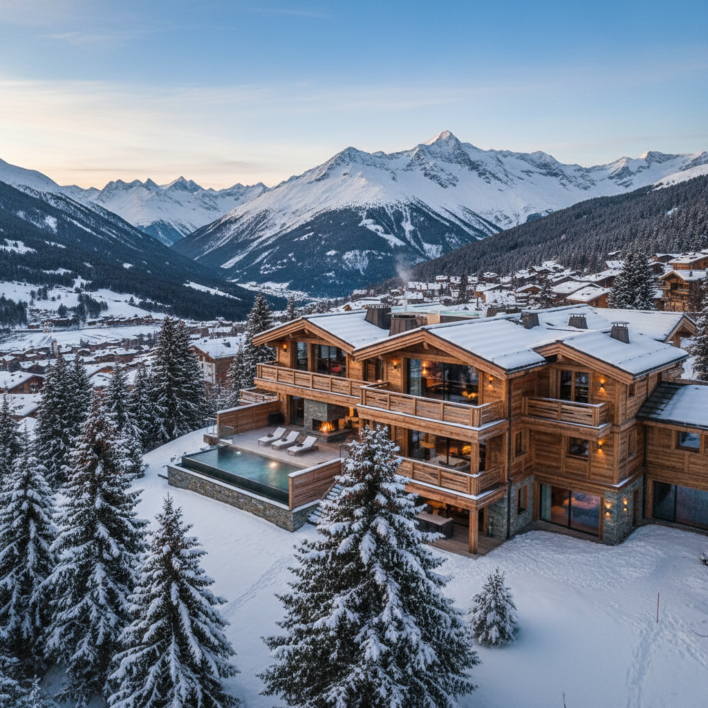
Location Overview
<p>Courchevel, located in the heart of the French Alps, is a world-renowned ski resort that offers much more than just winter sports. The region is a hiker's paradise, with a network of trails that cater to all skill levels. The Courchevel Summit Trail is one of the most challenging and rewarding hikes in the area, taking you through a diverse landscape that showcases the best of the French Alps. The trail starts near the resort town of Courchevel and ascends to the highest point in the vicinity, offering panoramic views of the surrounding mountains.</p><p>The landscape around Courchevel is characterized by a mix of dense forests, alpine meadows, and rocky peaks. The area is part of the Vanoise National Park, which was established in 1963 to protect the unique flora and fauna of the region. The park is home to a variety of wildlife, including ibex, chamois, and marmots, making it a great destination for nature lovers. The Courchevel Summit Trail passes through several sections of the park, allowing hikers to experience the pristine beauty of the Alps up close.</p><p>What makes Courchevel an exceptional destination for hiking is the combination of its natural beauty and the well-developed infrastructure. The resort town offers a range of amenities, from cozy mountain lodges to gourmet restaurants, ensuring that hikers can enjoy a comfortable base after a day on the trails. The Courchevel Summit Trail is just one of many hiking options in the area, making it a perfect destination for those who want to explore the French Alps in depth.</p>
Key Points of Interest
<p><strong>Start Point: Courchevel 1850 Car Park</strong><br>The trail begins at the Courchevel 1850 Car Park, located near the center of the resort. This is a popular starting point for many hikes in the area, and the car park is well-maintained and easy to find.</p><p><strong>Forest of La Rosière</strong><br>As you leave the car park, you'll enter the dense Forest of La Rosière. This section of the trail is relatively gentle and shaded, providing a cool and peaceful start to your hike. The forest is home to a variety of bird species, and you might hear the calls of woodpeckers and finches as you walk.</p><p><strong>Alpage de la Rosière</strong><br>After about 2 kilometers, the trail opens up into the Alpage de la Rosière, a beautiful alpine meadow. This is a perfect spot to stop for a picnic and take in the views of the surrounding mountains. In the summer, the meadow is carpeted with wildflowers, and you might see herds of cows grazing on the lush grass.</p><p><strong>Col de la Vanoise</strong><br>The trail continues to ascend, eventually reaching the Col de la Vanoise, a high mountain pass. At an elevation of 2,360 meters, the pass offers sweeping views of the Vanoise National Park and the Mont Blanc massif. This is a great place to catch your breath and enjoy the scenery before the final push to the summit.</p><p><strong>Summit of Pointe Percée</strong><br>The final section of the trail is the most challenging, as you ascend the rocky slopes of Pointe Percée. The summit is at an elevation of 2,750 meters and provides a panoramic view of the entire region. On a clear day, you can see for miles, taking in the peaks of the French Alps and the valleys below.</p><p><strong>Descent to Alpage de la Rosière</strong><br>The descent from the summit follows the same route as the ascent, passing back through the Alpage de la Rosière. The meadow is just as beautiful on the way down, and you might have the chance to see more wildlife as you return to the forest.</p>
Route Waypoints
- Forest of La Rosière: A dense forest that provides a cool and shaded start to the hike.
- Alpage de la Rosière: A beautiful alpine meadow with views of the surrounding mountains.
- Col de la Vanoise: A high mountain pass with panoramic views of the Vanoise National Park.
- Summit of Pointe Percée: The highest point of the trail, offering a 360-degree view of the French Alps.
- Descent to Alpage de la Rosière: The return route through the alpine meadow.
- Forest of La Rosière: The same forest you hiked through at the start, now on the descent.
Getting to the Start
<p>To reach the start of the Courchevel Summit Trail, you'll need to head to the resort town of Courchevel. The nearest major town is Moûtiers, which is about 20 kilometers away. From Moûtiers, you can take the D150 road, which leads directly to Courchevel. The drive is scenic, passing through picturesque villages and winding through the mountains. Once you reach Courchevel, you can park at the Courchevel 1850 Car Park, which is located near the center of the resort. This car park is large and can accommodate a significant number of vehicles, though it can get busy during peak season. Parking is free, but there are time limits, so it's best to check the signs upon arrival.</p><p>If you prefer public transport, the nearest train station is in Moûtiers. From there, you can take a bus to Courchevel. The bus service is reliable and runs frequently during the summer months. The bus stop is located near the car park, making it easy to access the trailhead. Whether you choose to drive or take public transport, the start of the Courchevel Summit Trail is well-marked and easy to find. Just follow the signs for the trailhead, and you'll be on your way to an unforgettable hiking adventure.</p>
Tips, Safety & Travel
<p>The Courchevel Summit Trail is a challenging hike that requires proper preparation and respect for the mountain environment. Here are some practical tips to ensure a safe and enjoyable experience:</p><p><strong>Parking and Access:</strong> The Courchevel 1850 Car Park is the best place to start your hike. Parking is free, but it can get busy during peak season, so arrive early to secure a spot. If you're using public transport, the bus from Moûtiers to Courchevel is reliable and runs frequently.</p><p><strong>Best Conditions and Season:</strong> The best time to hike the Courchevel Summit Trail is during the summer months, from June to September. The weather is generally mild, and the trails are clear of snow. However, the weather in the mountains can be unpredictable, so always check the forecast before setting out. Early morning or late afternoon are the best times to avoid the heat and the crowds.</p><p><strong>What to Bring:</strong> Essential items for your hike include a map, compass, and plenty of water. A lightweight backpack, sturdy hiking boots, and layered clothing are also important. Bring a first-aid kit, sun protection, and a whistle to signal for help if needed. A camera is a must to capture the stunning views along the way.</p><p><strong>Safety Advice:</strong> The trail is well-marked, but it's still important to stay on the designated path. The terrain can be steep and rocky, especially near the summit, so use caution and watch your step. If you're hiking alone, let someone know your route and expected return time. Always carry a charged mobile phone, but be aware that reception can be patchy in remote areas.</p><p><strong>Weather and Terrain Hazards:</strong> The weather in the mountains can change quickly, so be prepared for all conditions. Thunderstorms are common in the afternoon, so plan to be off the summit by early afternoon. The trail can be slippery when wet, and loose rocks can pose a hazard, especially on the steeper sections. Be mindful of your surroundings and avoid overhanging cliffs or steep drop-offs.</p><p><strong>Emergency Notes:</strong> In case of an emergency, the emergency number in France is 112. If you need medical assistance or rescue, stay calm and try to provide your exact location. It's a good idea to carry a map and a GPS device to help rescuers find you. Always hike with a partner or in a group, and never take unnecessary risks.</p>
Wildlife & Nature Highlights
<p>The Courchevel Summit Trail is not only a feast for the eyes but also a haven for wildlife enthusiasts. The Vanoise National Park, which encompasses much of the trail, is home to a rich variety of flora and fauna. As you hike, keep an eye out for the Alpine ibex, a majestic mountain goat that is a symbol of the region. These animals are often seen grazing on the steep slopes and rocky outcrops. Another common sight is the chamois, a smaller mountain goat that is known for its agility and speed. Both species are well-adapted to the harsh alpine environment and are a delight to observe in their natural habitat.</p><p>Alpine marmots are another highlight of the trail. These large ground squirrels are known for their distinctive whistles, which they use to communicate with each other. You're likely to hear them before you see them, as they often hide in their burrows or sun themselves on rocky ledges. The meadows along the trail are also home to a variety of wildflowers, including the iconic edelweiss, which is a symbol of the Alps. The flowers bloom in the summer months, adding a splash of color to the landscape. The geology of the area is equally fascinating, with the rocky outcrops and scree slopes providing a glimpse into the ancient history of the region.</p>
Tags
- hiking
- French Alps
- Courchevel
- Vanoise National Park
- mountain views
- wildlife
- summer hiking
- challenging trail