Activity: Hiking | Difficulty: Hard | Location: Carronshore, Scotland
The Carronshore Summit Trail is a hard-rated hiking route that covers approximately 10 kilometers of rugged terrain. The trail is an out-and-back route that takes you to the highest point near Carronshore, offering stunning views of the Ochil Hills and the Carron Valley Reservoir.
Adventure Statistics
- Distance: 10.0km
- Duration: 1h 45m
- Elevation Gain: 330m
- Max Elevation: 450m
- Calories Burned: 795
- Best Seasons: Spring, Summer, Fall
- Features: Viewpoint, Summit, Forest, Lake, River, Wildlife_viewing
Photos
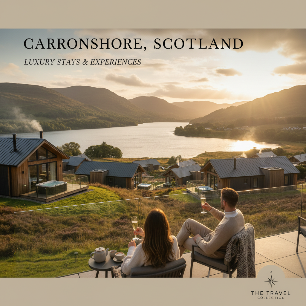
Location Overview
<p>Carronshore, located in the heart of Stirlingshire, Scotland, is a picturesque village that serves as the gateway to a vast and varied landscape. The area is characterized by rolling hills, dense woodlands, and serene water bodies, making it a perfect destination for outdoor enthusiasts. The Carron Valley Reservoir, a large man-made lake, is a prominent feature of the landscape, offering stunning views and a tranquil atmosphere. The surrounding hills, part of the Ochil Hills range, provide a dramatic backdrop to the village and are home to a network of hiking trails, including the Carronshore Summit Trail.</p><p>The landscape around Carronshore is a mix of natural and managed environments. The Ochil Hills are part of the wider Central Scotland Green Network, which aims to enhance the natural and cultural heritage of the region. The hills are covered in a patchwork of heather moorland, coniferous forests, and open grassland, each habitat supporting a diverse range of flora and fauna. The Carron Valley Reservoir, created in the 1950s, is a vital water resource for the region and has become an important site for wildlife and recreation.</p><p>Carronshore itself is a small, peaceful village with a strong community spirit. The village is home to a few local amenities, including a pub and a community center, which serve as gathering points for residents and visitors alike. The village is also a popular base for hikers, cyclists, and nature lovers, who come to explore the surrounding countryside. The Carronshore Summit Trail is just one of many hiking routes in the area, each offering its own unique experience and challenges. Whether you're looking for a leisurely stroll or a more strenuous hike, Carronshore and its surroundings have something to offer everyone.</p>
Key Points of Interest
<p><strong>1. Carron Valley Reservoir:</strong> The trail begins at the Carron Valley Reservoir car park, where you can enjoy the serene views of the lake. The reservoir is a popular spot for fishing and boating, and you might see local anglers or water sports enthusiasts. The path from the car park leads you into the woods, setting the stage for the hike ahead.</p><p><strong>2. Woodland Path:</strong> As you leave the car park, the trail takes you through a dense woodland area. The forest here is primarily composed of pine trees, creating a cool and shaded environment. The path is relatively flat at this point, making it a good opportunity to warm up and get into a comfortable hiking pace. Listen for the sounds of birds and the rustling of leaves as you make your way through the woods.</p><p><strong>3. Open Moorland:</strong> After about 2 kilometers, the trail emerges from the woodland and opens up into the heather-covered moorland. The landscape here is vast and open, with sweeping views of the surrounding hills. The path becomes more rugged, with rocky sections and uneven terrain. This is a good place to stop and take in the panoramic views, especially if the weather is clear.</p><p><strong>4. Mid-Point Lookout:</strong> At the midpoint of the trail, you'll reach a small rocky outcrop that offers a natural viewpoint. From here, you can see the Carron Valley Reservoir to the south and the higher peaks of the Ochil Hills to the north. This is a great spot to take a break, have a snack, and enjoy the tranquility of the surroundings. The views from this point are particularly stunning during sunrise or sunset.</p><p><strong>5. Summit:</strong> The final push to the summit is the most challenging part of the hike. The path becomes steeper, and you may need to use your hands to scramble over some of the rocky sections. The effort is well worth it, as the summit offers breathtaking 360-degree views. On a clear day, you can see as far as the Forth Estuary and the distant peaks of the Scottish Highlands. The summit is a rewarding destination and a perfect spot to celebrate your achievement.</p><p><strong>6. Descent:</strong> The descent follows the same route as the ascent, but the changing light and perspective can make it feel like a different experience. As you make your way back down, take the time to appreciate the different aspects of the landscape. The descent can be quicker, but it's important to remain cautious, especially on the rocky sections. The path back to the car park is a satisfying conclusion to a challenging and rewarding hike.</p>
Route Waypoints
- Woodland Entrance: The trail enters a dense woodland area, primarily composed of pine trees. The path is relatively flat and shaded, making it a good place to warm up.
- Moorland Edge: The trail emerges from the woods into the heather-covered moorland. The landscape becomes more open, with sweeping views of the surrounding hills.
- Mid-Point Lookout: A small rocky outcrop that offers a natural viewpoint. From here, you can see the Carron Valley Reservoir to the south and the higher peaks of the Ochil Hills to the north.
- Summit: The highest point of the trail, offering breathtaking 360-degree views. On a clear day, you can see as far as the Forth Estuary and the distant peaks of the Scottish Highlands.
- Descent Path: The descent follows the same route as the ascent, but the changing light and perspective can make it feel like a different experience. The path back to the car park is a satisfying conclusion to a challenging and rewarding hike.
- Moorland Return: As you make your way back down, you'll pass through the same heather-covered moorland. The views from this point are particularly stunning during sunrise or sunset.
Getting to the Start
<p>To reach the start of the Carronshore Summit Trail, you can drive from the nearest town, Falkirk, which is approximately 15 kilometers away. From Falkirk, take the A870 north towards Stirling, then turn onto the B822, which will lead you to Carronshore. Follow the B822 until you reach the village, and you'll find the trailhead at the Carron Valley Reservoir car park. The car park is located just off the B822 and is well-signposted. It is a large, free car park that can accommodate several vehicles, making it a convenient starting point for your hike.</p><p>If you're traveling by public transport, the nearest train station is in Falkirk, which is served by regular trains from Glasgow and Edinburgh. From Falkirk, you can take a bus or taxi to Carronshore. The bus service is limited, so it's advisable to check the schedule in advance. Alternatively, you can arrange for a taxi to take you to the village, which is a relatively short and scenic journey. Once you arrive in Carronshore, you can walk to the trailhead at the Carron Valley Reservoir car park, which is a short distance from the village center.</p><p>The Carron Valley Reservoir car park is a popular starting point for many hiking routes in the area, so you may encounter other hikers and outdoor enthusiasts. The car park is well-maintained and provides ample space for vehicles. There are no facilities at the car park, but there are public restrooms in the village of Carronshore. It's a good idea to bring all the necessary supplies for your hike, including water, snacks, and any other gear you might need.</p>
Tips, Safety & Travel
<p>**Parking:** The Carron Valley Reservoir car park is a large, free car park that can accommodate several vehicles. It is well-maintained and provides a convenient starting point for your hike. There are no facilities at the car park, so it's a good idea to bring all the necessary supplies, including water, snacks, and a map of the trail.</p><p>**Best Conditions and Season:** The Carronshore Summit Trail is best tackled in the warmer months, from late spring to early fall. The weather is generally more stable during this period, and the terrain is less treacherous. However, even in the summer, it's important to be prepared for changing weather conditions. The Scottish Highlands can be unpredictable, so always check the weather forecast before you set out and be prepared for rain or strong winds.</p><p>**What to Bring:** Essential items for your hike include a sturdy pair of hiking boots, appropriate clothing for the weather, a map of the trail, a compass, and a GPS device if you have one. Bring plenty of water and snacks, as there are no facilities along the trail. A first-aid kit, a whistle, and a mobile phone are also recommended for safety. If you plan to spend a longer time on the trail, consider bringing a lightweight jacket and a hat to protect yourself from the sun.</p><p>**Safety Advice:** The Carronshore Summit Trail is a challenging route that requires a good level of fitness and experience. The terrain is rugged, with steep ascents and descents, and the path can be rocky and uneven. It's important to stay on the marked trail and to follow the signs carefully, especially in areas where the path is less defined. If you're hiking alone, let someone know your planned route and expected return time. Always carry a charged mobile phone in case of emergencies, and be aware of the nearest emergency services.</p><p>**Weather and Terrain Hazards:** The weather in the Scottish Highlands can change rapidly, and it's important to be prepared for all conditions. Strong winds and heavy rain can make the trail slippery and dangerous, especially on the rocky sections. In the winter, the trail can be icy and snow-covered, making it unsuitable for hiking. Always check the weather forecast before you set out and consider rescheduling your hike if conditions are unfavorable. If you do encounter poor weather, turn back if necessary and prioritize your safety.</p><p>**Emergency Notes:** In case of an emergency, dial 999 or 112 from your mobile phone. The nearest hospital is in Falkirk, and there are several GP surgeries in the area. If you need to contact the local mountain rescue team, you can call the Scottish Mountain Rescue on 01324 862211. Always carry a whistle and a map, and be prepared to use them in case you become lost or injured.</p>
Wildlife & Nature Highlights
<p>The Carronshore Summit Trail is not only a challenging hike but also a haven for wildlife enthusiasts. The area around the trail is rich in biodiversity, with a variety of flora and fauna that can be observed throughout the year. As you make your way along the trail, keep an eye out for the following highlights:</p><p>**Birds:** The Ochil Hills and the surrounding woodlands are home to a diverse range of bird species. You might spot red grouse, which are known for their distinctive calls and can often be seen on the heather-covered moorland. Golden plovers, with their beautiful golden and black plumage, can also be found in the open areas. Other birds you might encounter include skylarks, which are known for their melodious songs, and buzzards, which can often be seen soaring above the hills.</p><p>**Mammals:** The area is also home to several mammal species. Roe deer are a common sight, especially in the early morning or late evening when they come out to feed. Red squirrels, with their distinctive red fur and bushy tails, can be found in the pine forests. If you're lucky, you might also spot a fox or a badger, although these animals are more elusive and tend to be active at night.</p><p>**Flora:** The vegetation along the Carronshore Summit Trail is diverse and changes as you move through different habitats. The lower sections of the trail are characterized by dense woodlands, where you can admire the towering trees and the rich undergrowth. As you ascend, the landscape transitions to heather moorland, where the purple heather blooms in the summer, creating a stunning visual display. Bilberry and bracken are also common, adding to the colorful tapestry of the hillside.</p><p>**Geology:** The Ochil Hills are part of an ancient geological formation, and the area around Carronshore is no exception. The hills are composed of a mix of sedimentary and volcanic rocks, which have been shaped by millions of years of erosion. The Carron Valley Reservoir, a man-made feature, has also influenced the local geology, creating a unique environment where water and land interact. The rocky outcrops and boulder fields along the trail provide a glimpse into the area's geological history and are a treat for those interested in the natural sciences.</p>
Tags
- hiking
- outdoor adventure
- Carronshore
- Ochil Hills
- Carron Valley Reservoir
- nature
- wildlife
- scenic views