Activity: Hiking | Difficulty: Hard | Location: Andalusia, Spain
The Andalusia Summit Trail is a challenging out-and-back route that covers a distance of approximately 12 kilometers. The trail features steep ascents and rocky terrain, making it suitable for experienced hikers. The summit offers panoramic views of the Andalusian countryside and the Sierra Nevada mountains.
Adventure Statistics
- Distance: 12.0km
- Duration: 1h 56m
- Elevation Gain: 600m
- Max Elevation: 1200m
- Calories Burned: 874
- Best Seasons: Spring, Summer, Fall, Winter
- Features: Summit, Forest, Viewpoint, Rocky outcrop, Oak forest, Mediterranean scrubland
Photos
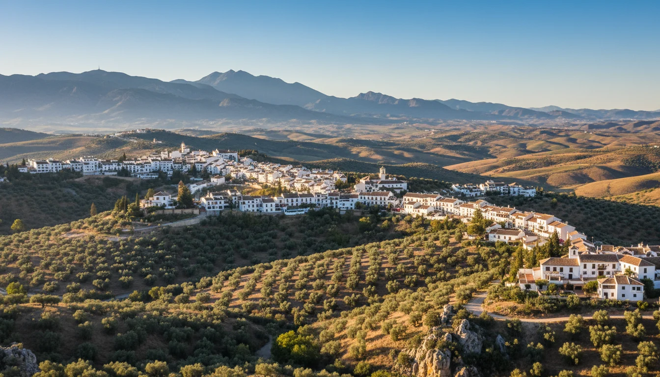
Location Overview
<p>Andalusia, located in southern Spain, is a region known for its rich cultural heritage and stunning natural landscapes. The Andalusia Summit Trail is situated in the Sierra de las Nieves, a mountain range that is part of the larger Baetic System. This area is characterized by its rugged terrain, dense forests, and diverse ecosystems. The landscape is a mix of Mediterranean scrubland, oak forests, and rocky outcrops, providing a diverse habitat for a wide range of flora and fauna.</p><p>The Sierra de las Nieves is a protected natural park, and the Andalusia Summit Trail is one of the many hiking routes that allow visitors to explore this beautiful area. The park is home to several species of endangered plants and animals, making it a valuable destination for nature enthusiasts and conservationists. The trail offers a unique opportunity to experience the natural beauty of Andalusia, from the serene forests to the dramatic mountain peaks.</p><p>What makes the Andalusia Summit Trail a great destination for hiking is its accessibility and the variety of landscapes it offers. The trail is well-maintained and marked, making it easy to navigate even for those who are new to the area. The trailhead is easily accessible from nearby towns, and there are several parking areas available for hikers. The trail is also suitable for day hikes or multi-day treks, depending on your preference and fitness level.</p>
Key Points of Interest
<p>1. <strong>El Burgo Village:</strong> The trailhead is located near the village of El Burgo, which is a charming Andalusian village with a rich history. The village is a great place to stop for a pre-hike coffee or a post-hike meal. The village also has a small museum that provides information about the local flora and fauna.</p><p>2. <strong>Oak Forest:</strong> As you begin your ascent, you'll enter a dense oak forest. The forest provides a cool, shaded environment, making it a welcome respite from the sun. The forest is home to a variety of bird species, and you may hear their calls as you hike through the trees.</p><p>3. <strong>Rocky Outcrop:</strong> About halfway up the trail, you'll reach a rocky outcrop that offers a panoramic view of the surrounding landscape. This is a great spot to take a break and enjoy the scenery. The outcrop is also a good place to observe the local geology, with exposed limestone formations that showcase the area's geological history.</p><p>4. <strong>Summit:</strong> The highlight of the trail is the summit, which offers a breathtaking 360-degree view of the Andalusian countryside. On a clear day, you can see the Sierra Nevada mountains in the distance. The summit is a popular spot for hikers to take photos and enjoy a well-deserved rest.</p><p>5. <strong>Descent:</strong> The descent from the summit follows a different route, passing through a different section of the forest. This part of the trail is less steep and offers a different perspective of the landscape. The descent is a good opportunity to observe the changing flora and fauna as you return to the trailhead.</p><p>6. <strong>El Burgo Village:</strong> Upon returning to the trailhead, you can explore the village of El Burgo. The village has a rich history and is known for its traditional architecture. You can visit the local shops and cafes, or take a stroll through the narrow streets to learn more about the local culture.</p>
Route Waypoints
- Oak Forest Entry: The trail enters a dense oak forest, providing a cool, shaded environment and a rich habitat for birds.
- Rocky Outcrop: A panoramic viewpoint halfway up the trail, offering a breathtaking view of the surrounding landscape.
- Summit: The highest point of the trail, offering a 360-degree view of the Andalusian countryside and the Sierra Nevada mountains.
- Forest Descent: The descent follows a different route through a different section of the forest, showcasing the changing flora and fauna.
Getting to the Start
<p>To reach the start of the Andalusia Summit Trail, you can begin your journey from the nearby town of Ronda, which is approximately 30 kilometers away. From Ronda, take the A-377 road towards El Burgo. Continue on this road for about 15 kilometers until you reach the village of El Burgo. From El Burgo, follow the signs for the Sierra de las Nieves Natural Park. The trailhead is located at the park's visitor center, which is well-marked and easy to find.</p><p>If you are driving, there is a designated parking area at the visitor center. The parking area is spacious and can accommodate several vehicles. There is no fee for parking, but it is important to park in designated areas to avoid obstructing the trailhead or other visitors. The parking area is well-maintained and provides a convenient starting point for your hike.</p><p>For those traveling by public transport, there are bus services that connect Ronda to El Burgo. From El Burgo, you can take a short taxi ride to the trailhead. It is advisable to check the bus schedules in advance, as services may be limited on weekends and holidays. Alternatively, you can consider carpooling or joining a guided hiking tour, which often provides transportation to and from the trailhead.</p>
Tips, Safety & Travel
<p>When hiking the Andalusia Summit Trail, it is important to be well-prepared and take necessary precautions to ensure a safe and enjoyable experience. The trail is best hiked during the spring and fall, when the weather is mild and the trails are less crowded. Summer can be very hot, and winter can bring cold temperatures and potential snowfall, making the trail more challenging.</p><p>Parking is available at the trailhead, and it is important to park in designated areas to avoid obstructing the trail or other visitors. The parking area is free and well-maintained. If you are traveling by public transport, consider taking a bus from Ronda to El Burgo and then a short taxi ride to the trailhead.</p><p>Before you start your hike, make sure to check the weather forecast and trail conditions. The trail can be steep and rocky in places, so sturdy hiking boots and appropriate clothing are essential. It is also a good idea to bring plenty of water, snacks, and a first-aid kit. Sunscreen and a hat are recommended, especially during the summer months.</p><p>While the trail is well-marked, it is still important to carry a map or GPS device to navigate the route. The summit can be windy, so bring a windbreaker or jacket. If you plan to hike the trail in the early morning or late afternoon, bring a headlamp or flashlight, as the trail can be dimly lit during these times.</p><p>Be mindful of the wildlife in the area and keep a safe distance from any animals you encounter. Do not feed the wildlife, and take all your trash with you. If you are hiking with a group, stay together and keep an eye on each other. In case of an emergency, the nearest medical facilities are in Ronda, and there are emergency phones available at the trailhead and at key points along the trail.</p>
Wildlife & Nature Highlights
<p>The Andalusia Summit Trail is a haven for wildlife enthusiasts, offering a rich diversity of flora and fauna. As you hike through the dense forests and open meadows, you'll have the opportunity to observe a variety of plant and animal species. The oak forests are home to several species of birds, including the Eurasian jay, the great spotted woodpecker, and the common buzzard. These birds can often be heard calling from the treetops, adding to the serene atmosphere of the trail.</p><p>Small mammals such as rabbits, squirrels, and hedgehogs are also common in the area. You may spot them darting through the underbrush or foraging for food. The rocky outcrops and cliffs provide habitat for reptiles, including the Iberian wall lizard and the Montpellier snake. These reptiles are well-adapted to the warm, sunny conditions of the region and can often be seen basking in the sun.</p><p>The trail also passes through areas of Mediterranean scrubland, which is characterized by low-growing shrubs and aromatic plants such as rosemary and lavender. These plants provide a rich source of nectar for insects, including butterflies and bees. The diverse plant life supports a wide range of insect species, contributing to the overall biodiversity of the area.</p><p>Geologically, the Sierra de las Nieves is composed of limestone and dolomite, which has been shaped by millions of years of erosion. The trail passes through areas of exposed rock, where you can observe the unique formations and textures of the limestone. The area is also known for its karst features, including sinkholes and underground caves. While these features are not directly accessible on the trail, their presence adds to the geological interest of the region.</p>
Tags
- hiking in Andalusia
- Andalusia Summit Trail
- outdoor adventure
- natural beauty
- panoramic views
- wildlife
- mountain hiking
- steep terrain